


PHOWN summaries and recordsVirtual Museum View records in Virtual Museum formatCoverage map for all species Species totals, Nest stats per species and Observer totals Species summary , or General query Observer records, or View VM record Photo of the week, or PHOWN repeats, or PHOWN priorities |
PHOWN observer summary
Choose an observer from the drop-down list and press the 'Go' button.
Your recent interesting PHOWN records
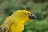
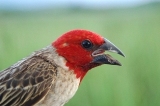
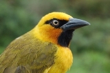
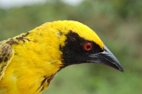
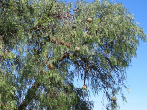
If any of your photos feature at Photos of the week, the recent ones will be shown here. Click on one to see its full record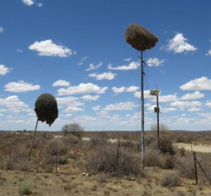 Vm 28253 Sociable Weaver - S nest on N10 |  Vm 28108 Sociable Weaver - nest in gums |  Vm 26828 Sociable Weaver - nest under bridge |  Vm 26800 Sociable Weaver - nest on roof |  Vm 26469 S Masked Weaver - nest with finch |  Vm 26255 S Masked Weaver - Caprivi colony |
Your PHOWN stats and species totals
Total records submitted to (and accepted in) PHOWN: 86
Total nests counted for PHOWN: 1258
| No. | Species | Records |
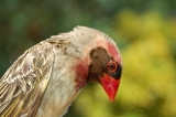
| 783 | Sociable Weaver | 8 |
| 791 | Spectacled Weaver | 1 |
| 792 | Lesser Masked Weaver | 1 |
| 797 | Village Weaver | 2 |
| 799 | Cape Weaver | 13 |
| 803 | Southern Masked Weaver | 15 |
| 804 | Thick-billed Weaver | 1 |
Map of your PHOWN records
Click on a thumb-nail to see the full record
Google map of records (you may need to zoom out to see all records)
Thumb-nails of your most recent PHOWN records
Click on one to see its full record Vm 31392 |  Vm 31391 |  Vm 31379 |  Vm 31376 |  Vm 31375 |  Vm 31372 |
 Vm 31365 |  Vm 31364 |  Vm 31363 |  Vm 31362 |  Vm 31361 |  Vm 31360 |
 Vm 31352 |  Vm 31350 |  Vm 31349 |  Vm 31348 |  Vm 31347 |  Vm 31340 |
List of all PHOWN records for this observer
Click on the VM number to see the full record
The list is sorted on species (as identified by the coordinator) and date of the record - this is followed by the country and locality
Records not identified by the coordinator are listed as null in the species column.
18341, Cape Weaver, 2015/11/13, South Africa, Roadside picnic spot on N9, approximately 25km south of Willowmore
18342, Southern Masked Weaver, 2015/11/14, South Africa, Southeast corner of pentad 3320_2315 next to N9 road, approximately 20km southwest of Willowmore
18505, Southern Masked Weaver, 2015/12/3, South Africa, Pentad 3300_2405, approximately 20km west of Klipplaat next to a minor dirt road
18648, , 2015/12/1, South Africa, On R75, approximately 47km WNW of Kirkwood
18740, Cape Weaver, 2016/1/24, South Africa, Off the R28, approximately 7km N of Mossel Bay
18742, Southern Masked Weaver, 2016/1/24, South Africa, On minor road between R328 and N9, approximately 21.5km SSE of Oudtshoorn
18743, Southern Masked Weaver, 2016/1/24, South Africa, On minor road between R328 and N9, approximately 19km south of Oudtshoorn
18744, Cape Weaver, 2016/1/24, South Africa, On minor road between R328 and N9, approximately 19km south of Oudtshoorn. Tall Tree about 21 nests
18746, , 2016/1/24, South Africa, On minor road between R328 and N9, approximately 21.5km SSE of Oudtshoorn.
24018, Southern Masked Weaver, 2016/4/11, South Africa, Klerksdorp Airport
24033, Thick-billed Weaver, 2013/12/28, Namibia, Camp Kwando, a lodge on the Kwando River in the Caprivi
24228, Cape Weaver, 2016/9/13, South Africa, BUCO building off St Francis Drive, Jeffreys Bay
24801, Sociable Weaver, 2016/12/9, South Africa, On N14, approximately 17km southwest of Aggeneys
24805, Sociable Weaver, 2016/10/6, South Africa, Farm Kantienpan, 44kms SW of Groblershoop
24827, , 2016/12/9, South Africa, Caravan park near golf course
25041, Southern Masked Weaver, 2017/1/22, South Africa, Roadside tree between Olifantshoek and Upington approximately 65 km SSE from Upington
25046, Lesser Masked Weaver, 2017/1/12, Botswana, Palm Afrique, game lodge in western Botswana, 10km SSE of Ghanzi, east of the A3. site covers and an area of approximately 500m.
25060, , 2017/1/17, Botswana, Exploration camp and drill site, 81km NE of Ghanzi. Observation area located within a radius of 2km from the central point indicated by the coordinates.
25062, Southern Masked Weaver, 2016/9/23, South Africa, Clump of trees at T-Junction of N10 with N12 1km north of Britstown
25145, Southern Masked Weaver, 2017/3/4, South Africa, Farm Hartebeestefontein
26173, , 2017/4/7, South Africa, Mala Mala Game Reserve. All entries or this location from an area radius of 25km from Rattrays Lodge
26204, Southern Masked Weaver, 2016/10/15, South Africa, Area around Homeep East Mine - old mine site 5km east of Concordia Town
26205, Cape Weaver, 2016/11/23, South Africa, Roadside tree on R27, 7.5km SE of Nieuwoudtville town.
26248, , 2016/12/5, South Africa, Tree on the northern side of Okiep/Concordia road, 3.8km SW of Concordia - Namaqualand
26255, Southern Masked Weaver, 2013/12/30, Namibia, Tourist Lodge on the Chobe River, Caprivi, Namibia
26469, Southern Masked Weaver, 2017/8/17, South Africa, Jesa Accommodation and Caravan Park. In Adendorp south of Graaff Reinet on the R75.
26483, Sociable Weaver, 2017/8/16, South Africa, Telephone pole next to the R357 between Copperton and Prieska
26800, Sociable Weaver, 2017/12/4, South Africa, Deserted village and railway siding on R383, 39km south-southeast of Groblershoop
26828, Sociable Weaver, 2017/12/14, South Africa, Underneath an overpass across the Sishen-Saldanha railway line,
26922, Cape Weaver, 2017/12/30, South Africa, Gamtoos River Mouth
27373, Southern Masked Weaver, 2017/10/29, South Africa, X-Ventures camp site on N1 7.9kms northwest of Beaufort West
28108, Sociable Weaver, 2018/12/9, South Africa, Picnic site on N10, 37km southeast of Prieska town
28253, Sociable Weaver, 2018/12/9, South Africa, Turnoff to Sodium railway station from N10, approximately 58km northwest of Britstown, southernmost Sociable Weaver Nest of N10
28443, Southern Masked Weaver, 2018/11/21, South Africa, Paradise Camp Site on N12 approximately 2.4km north of Victoria West
29342, Cape Weaver, 2019/8/21, South Africa, Earth dam in retirement village
29350, Cape Weaver, 2019/9/1, South Africa, Gamtoos River Mouth
29653, Cape Weaver, 2020/9/18, South Africa, Pentad 3400_2440, 8km WNW of Humansdorp, traversed by R102 and N2, dirt road heading north from R102
29654, Cape Weaver, 2020/12/26, South Africa, Pentad 3340_2305 - pentad center 5km south of Uniondale, traversed by R339 (Uniondale Poort) and R62, N9 cuts NW corner
29664, Village Weaver, 2021/1/3, South Africa, Pentad 3400_2440, 8km WNW of Humansdorp, traversed by R102 and N2, dirt road heading north from R102
29918, Southern Masked Weaver, 2021/2/14, South Africa, The Wattlechop campsite and an area of approximately 2km radius around it.
30428, Southern Masked Weaver, 2021/12/23, South Africa, Farm Hartebeestefontein
30542, Village Weaver, 2021/12/19, South Africa, Pentad 3335_2430 - 28km northwest of Patensie at entrance to Baviaans Reserve, traversed by R331 in the south, mostly mountains. Coordinates are pentad centre coordinates, actual record GPS coordinates included where available.
30887, Cape Weaver, 2022/8/28, South Africa, Earth dam in retirement village
30902, Cape Weaver, 2022/9/13, South Africa, Van Stadens River Mouth Resort - Resort area seaside at river mouth.
30911, Cape Weaver, 2022/9/22, South Africa, Pentad 3355_2250 - Area in Garden Route located 9km north-east of Sedgefield. Traversed by the Karatara and Barrington Roads. Pentad centre coordinates given; actual record GPS noted where available.
30920, , 2022/9/21, South Africa, Pentad 3340_2255 - Area located 17km southwest of Uniondale, traversed by N9 and the Kammanassie Road. Pentad centre coordinates given. Record location coordinates supplied where available.
30957, , 2022/10/26, South Africa, Steenbokkie Private Nature Reserve - a camping site located 6km east-northeast of Beaufort West in the northeastern corner of Pentad 3220_2235.
30958, , 2022/11/4, South Africa, Farm Hartebeestefontein
30983, , 2022/12/15, South Africa, Pentad 3320_2115 – Swartberg, northeast of Seweweekspoort, 13km north of Ladismith. Traversed by the R323 only. Pentad centre coordinates given; record GPS noted where available.
30984, , 2022/12/15, South Africa, Pentad 3320_2115 – Swartberg, northeast of Seweweekspoort, 13km north of Ladismith. Traversed by the R323 only. Pentad centre coordinates given; record GPS noted where available.
30985, , 2022/12/8, South Africa, Pentad 3420_2140 – Coastal zone with private nature reserves extending inland from beach – 22km southeast from Albertinia. Traversed by a number of secondary roads. Pentad centre coordinates given; record GPS noted where available.
30986, , 2022/12/8, South Africa, Pentad 3420_2140 – Coastal zone with private nature reserves extending inland from beach – 22km southeast from Albertinia. Traversed by a number of secondary roads. Pentad centre coordinates given; record GPS noted where available.
30989, , 2022/12/7, South Africa, Pentad 3350_2400 – Eastern Kouga Mountains and Krom River valley – 18km WNW of Joubertina. Traversed by the R62 and a number of secondary roads. Pentad centre coordinates given; record GPS noted where available.
30990, , 2022/12/7, South Africa, Pentad 3345_2340 – Langkloof valley and mountains. Traversed by the R62 and a number of secondary roads – 3km northwest of Krakeel River. Pentad centre coordinates given; record GPS noted where available.
30991, , 2022/10/25, South Africa, Pentad 3320_2305 – Swartberg East and Toorwater train-pass. Traversed by the R407 and a number of secondary roads – 30km north of Uniondale. Pentad centre coordinates given; record GPS noted where available.
30997, , 2022/9/15, South Africa, Pentad 3335_2305 – Uniondale town and pentad area to the north. Traversed by the N9, R339 and a number of unpaved secondary roads. Pentad centre coordinates given; record GPS noted where available.
30998, , 2022/9/15, South Africa, Pentad 3340_2310 – Western end of Bo-Kouga located 9 km southeast of Uniondale near Avontuur. Traversed by the R62, R339 and a number of unpaved secondary roads. Pentad centre coordinates given; record GPS noted where available
31002, , 2023/2/12, South Africa, Animal watering pool alongside an N2 picnic spot - located 5km WSW of Riviersonderend
31003, , 2023/3/11, South Africa, Pentad 3350_2455 – Gamtoos flood plain and surrounding hills - 6km west of Loerie town, traversed by the R331 and a number of secondary roads. Pentad centre coordinates given; record GPS noted where available.
31068, Spectacled Weaver, 2023/4/26, South Africa, Great Fish River Estuary and a 3km radius area around it - southwest corner of Pentad 3325_2705. Marine, riverine and natural veld. Locality coordinate from bridge center. Pentad
31114, Sociable Weaver, 2017/11/2, South Africa, Deserted village and railway siding on R383, 39km south-southeast of Groblershoop
31187, , 2023/6/30, South Africa, Ou Klipskuur Campsite on R356 to Loxton, 24km northwest of Fraserburg
31188, , 2023/7/1, South Africa, On unpaved secondary road from Brandvlei to Loop10 rail junction, 43 km northwest of Brandvlei, Pentad 3010_2005
31195, , 2023/7/22, Namibia, On D511, 18km south of Twee Rivier in dune-veld of central western Namibia
31227, , 2023/9/22, Namibia, Courtyard of guesthouse in Klein Windhoek, Windhoek Namibia
31228, , 2013/12/20, Namibia, On unpaved D1033 in Olifants River bed, Kalahari dunes. 39km southeast of Gochas
31229, , 2023/7/21, Namibia, On unpaved D1033 in Olifants River bed, Kalahari dunes. 39km southeast of Gochas
31251, , 2023/12/3, Namibia, On the unpaved D1972 past Gross Barmen, 7km northwest of the Swakkoppoort Dam, 33km southeast of Wilhelmstal
31340, , 2024/1/23, South Africa, Alice Road in Cannon Rocks Resort, 100m from beach, 4.9km WSW of Boknes, Pentad 3345_2630
31347, , 2023/7/22, Namibia, On D511, 22km northeast of Koes on western edge of the dune-veld of central western Namibia
31348, , 2023/7/22, Namibia, On C11 west of a pan, 52km north of Aroab on the western edge of the dune-veld of central western Namibia
31349, , 2023/7/22, Namibia, On C11 west of a pan, 50km north of Aroab on the western edge of the dune-veld of central western Namibia
31350, , 2023/7/22, South Africa, Kalahari dune plains. On R360, 80km south of Askham, Pentad 2740_2045
31352, , 2024/1/19, South Africa, Farm Hartebeestefontein
31360, , 2017/12/14, South Africa, Deserted village and railway siding on R383, 39km south-southeast of Groblershoop
31361, , 2023/7/21, Namibia, On unpaved road M51 20km southeast of Windhoek International Airport.
31362, , 2023/7/21, Namibia, On unpaved D1775 road in the Kalahari duneveld of central eastern Namibia, 48km northwest of Aranos
31363, , 2023/7/21, Namibia, Off the unpaved D1033 in the dry Olifants River bed, Kalahari dunes. 36km northeast of Stampriet
31364, , 2023/7/21, Namibia, On unpaved D1033 in Olifants River bed, Kalahari dunes. 41km NNE of Gochas
31365, , 2023/7/21, Namibia, Off the unpaved D1033 in Olifants River bed, Kalahari dunes. 35km southeast of Gochas
31372, , 2024/3/11, South Africa, Small earth dam next to unpaved road through Soutkloof in the Sapkamma Mountains, 17km east of Kleinpoort, Pentad 3320_2500
31375, , 2024/3/15, South Africa, Windpump and water hole on field track on farm Stoepies, 45km southwest of Aberdeen, Pentad 3245_2345
31376, , 2024/3/17, South Africa, Hill and trees around the Ruiterspoort farm house, 30km east of Willowmore, Pentad 3315_2345
31379, , 2023/6/20, Namibia, Garden of a guesthouse in the Tauben Glen residential area of Windhoek
31391, , 2023/9/27, Namibia, Garden of Kwetu Coffee Shop off the B2 in Wilhelmstal
31392, , 2023/9/27, Namibia, Garden of Kwetu Coffee Shop off the B2 in Wilhelmstal