


Swartberg hike, 28 May - 1 June 2002
The Trails Club of South Africa invited me to hike the Swartberg with them from 28 May to 1 June 2002. Below are some pictures of the hike, followed by my (short) bird list. Read more about our hike, report written by Margie Crawley
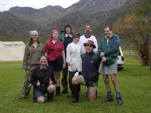 Photo H.D. Oschadleus |
28/05/2002 (Day 1) Start of Swartberg hike: Ramona, Marie-Paule, Dieter, Jenny, Vincent, Paul, Margie, Conrad. |
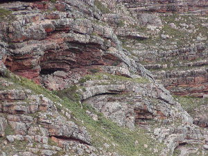 Photo H.D. Oschadleus |
28/05/2002 (Day 1) Folded rock formations. Our route on the first day was from De Hoek campsite to Gouekrans hut, starting with a long steep ascent, and a total distance of 12,1 km. |
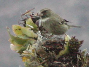 Photo H.D. Oschadleus |
28/05/2002 (Day 1) Protea Canary feeding on protea at Gouekrans hut. |
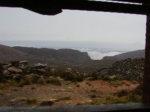 Photo H.D. Oschadleus |
28/05/2002 (Day 1) View north from Gouekrans hut. |
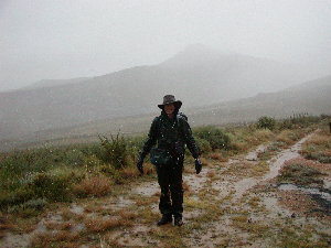 Photo H.D. Oschadleus |
29/05/2002 (Day 2) We started hiking from Gouekrans in light rain, which turned into icy sleet and then snow by the time we arrived at Bothashoek hut. Distance 13 km. |
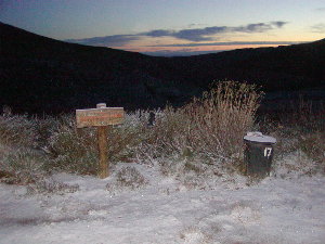 Photo H.D. Oschadleus |
30/05/2002 (Day 3) Sunrise at Bothashoek hut, with a light covering of snow on the ground. |
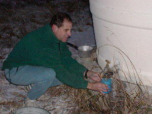 Photo H.D. Oschadleus |
30/05/2002 (Day 3) The water in the tap at Bothashoek hut was frozen early in the morning so Paul heated the tap with his gas cooker. |
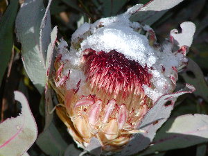 Photo H.D. Oschadleus |
30/05/2002 (Day 3) 'Snow Protea' Today was sunny and we could start drying out on our hike from Bothashoek to Ou Tol. Distance 13 km. |
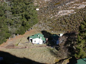 Photo H.D. Oschadleus |
30/05/2002 (Day 3) Ou Tol hut from koppie. The Swartberg Pass road runs past behind the pine trees. We sat in the sun against the wall of the hut to thaw out! |
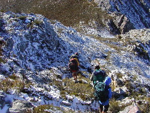 Photo H.D. Oschadleus |
31/05/2002 (Day 4) We hiked from Ou Tol to Bothashoek along the summit route, distance 12.6 km. Another sunny day, otherwise the summit route would not be possible. There was still snow on the shaded south slopes. |
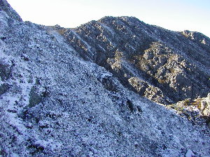 Photo H.D. Oschadleus |
31/05/2002 (Day 4) More snow on the summit route. |
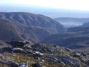 Photo H.D. Oschadleus |
31/05/2002 (Day 4) View of Gouekrans cliffs from summit route. No snow left on the northern slopes. |
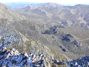 Photo H.D. Oschadleus |
31/05/2002 (Day 4) Looking back at Ou Tol hut and the Swartberg Pass road from summit route. |
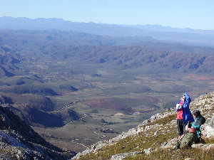 Photo H.D. Oschadleus |
31/05/2002 (Day 4) View from summit route overlooking Outeniqua Mts. |
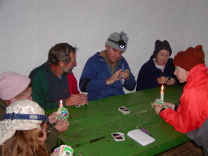 Photo H.D. Oschadleus |
31/05/2002 (Day 4) Our last game of Uno in Bothashoek hut on our last night on the trail. The next day we descended from Bothashoek to the De Hoek campsite in heavy rain which abated as we descended. Distance 8.7 km. |
Bird list for the Swartberg trail, 28 May - 1 June 2002, square 3322AC
Only 15 species were recorded on the trail, partly because of the bad weather on several days. The most recent checklist for the Swartberg is: Dave Osborne and Rob Little, 1999, Birds of the Swartberg and Gamkapoort Nature Reserves (see ADU publications). Birds marked with * below indicate a new month record for the species. This list is only on the trail, not including the De Hoek campsite.* Black Eagle Aquila verreauxii
Jackal Buzzard Buteo rufofuscus
* Rock Kestrel Falco tinnunculus
* Cape Eagle Owl Bubo capensis
Ground Woodpecker Geocolaptes olivaceus
Cape Rockjumper Chaetops frenatus
Grassbird Sphenoeacus afer
Karoo Prinia Prinia maculosa
* Redwinged Starling Onychognathus morio
Cape Sugarbird Promerops cafer
Malachite Sunbird Nectarinia famosa
Orangebreasted Sunbird Nectarinia violacea
Cape Siskin Pseudochloroptila totta
Protea Canary Serinus leucopterus
Cape Bunting Emberiza capensis
The most frequently recorded species was Orangebreasted Sunbird. Cape Siskins were seen several times in flocks of 20-30 birds; they were often seen foraging in the worst weather, including snow and rain.
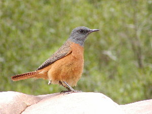
Photo H.D. Oschadleus
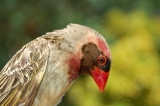
27/05/2002, male Cape Rock Thrush, Meiringspoort Pass picnic spot (en route to the hike)